Bicycling
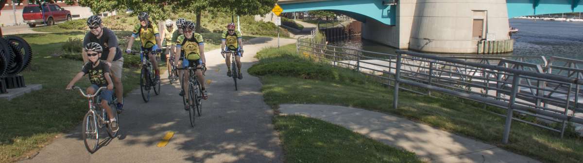
Racine County is a great place for bicycling in a bicycle-friendly state. With nearly 120 miles of designated bicycle routes and recreation trails, cyclists young and old can enjoy this family-friendly pastime.
Cycling opportunities extend from the Lake Michigan shoreline to a scenic, paved four-mile trail along the Root River in the City of Racine. Former railroad corridors provide easy pathways extending north, south and west from the city.
The Pike River Pathway in Mount Pleasant is a paved trail that meanders north and south through the restored Pike River wetlands. It can be reached from the east-west Racine County Trail or at Case High School on Washington Avenue (Hwy 20).
Lengthy bike paths run through rural parts of the county. The 17-mile Seven Waters Trail runs from Congress Street in Burlington north along the Fox River through the villages of Rochester and Waterford and the town of Norway.
The White River State Trail extends east seven miles from Burlington's Bushell Park to the town of Dover. The trail's western leg is just west of Burlington (off Spring Valley Road) and runs west 12 miles into Walworth County.
Download Racine County Bicycle Trails Interactive Maps
Lake Michigan Pathway
Length: 14 miles
3 Mile Road/MRK Trail and Douglas Ave. and Chicory Road/North Shore Trail between Lathrop Ave. and S. Memorial Dr. (Racine)
WE Energies Trail
Length: 2 miles
7 Mile Rd. east of Douglas Ave./SR 32 (Racine) and E Elm Rd. east of S Chicago Rd./SR 32 (Oak Creek)
North Shore Trail
Length: 3 miles
16th St. and West Blvd. (Racine) and Kenosha County Bike Trail at 1st St. (Racine-Kenosha county line)
Pike River Pathway
Length: 5.3 miles
Old Spring St. west of Timmer Ln. and South of State Rte. 11
Racine County 100-Mile Circle
Combination of rural roads and off-road trails
Sights include the Tichigan Wildlife Refuge, Fox River, Root River, Racine Zoo, and SC Johnson headquarters campus
Racine/Sturtevant Trail
Length: 3.5 miles
North Shore Trail at West Blvd. just north of 19th St. (Racine) and Willow Rd. (Mt. Pleasant)
Root River Pathway
Length: 6.6 miles
MRK Trail at Layard Ave. and Washington Ave.
Combination of off-road trail and on-road route
Trail links together a number of city parks including Cedar Bend, Horlick, Lincoln, Colonial, Brose, Island, and Belle City
Seven Waters Trail
Length: 17.6 miles
Congress St. at Wehmhoff Jucker Park (Burlington) and SR 36 at US 45 (south of Franklin)
White River State Trail
Length: 19 miles
Co. Hwy. H (Elkhorn) to Spring Valley Rd. at Burlington Bypass (Burlington) and Calumet St. at State St. (Burlington) to Vandenboom Rd. (Kansasville)